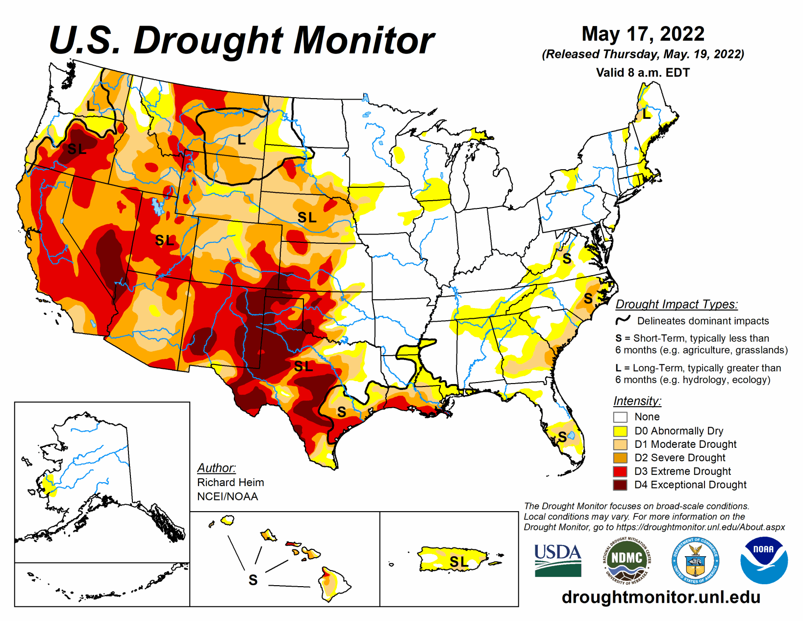
In the upper levels of the atmosphere, a strong ridge of high pressure dominated the contiguous U.S., from the southern Plains to Northeast, at the beginning of this U.S. Drought Monitor week, while an upper-level trough dominated the West. The trough moved east as the week progressed, dragging a surface low pressure system and cold fronts across the northern Plains to Great Lakes, while another upper-level low moved over the Southeast and weakened.
Weekly temperatures averaged much warmer than normal beneath the ridge and cooler than normal in the West beneath the trough. The fronts, lows, and upper-level troughs brought above-normal precipitation to parts of the Pacific Northwest, northern Plains to western Great Lakes, and spotty areas in the South, New England, and along the Atlantic Coast. The week was drier than normal across the rest of the CONUS. The continued lack of precipitation further dried soils, lowered stream levels, and stressed crops and other vegetation, while the excessively warm temperatures increased evapotranspiration and added to the stress.
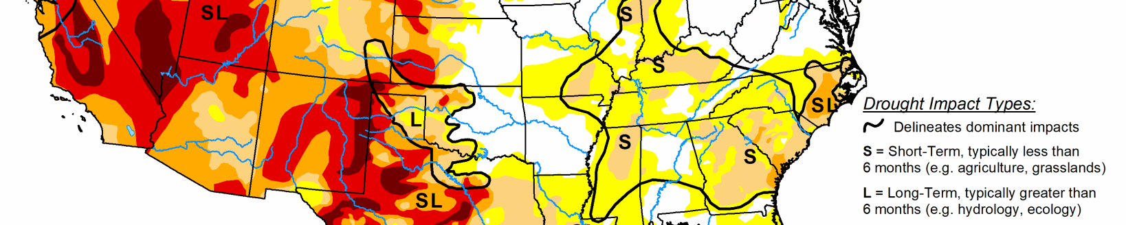
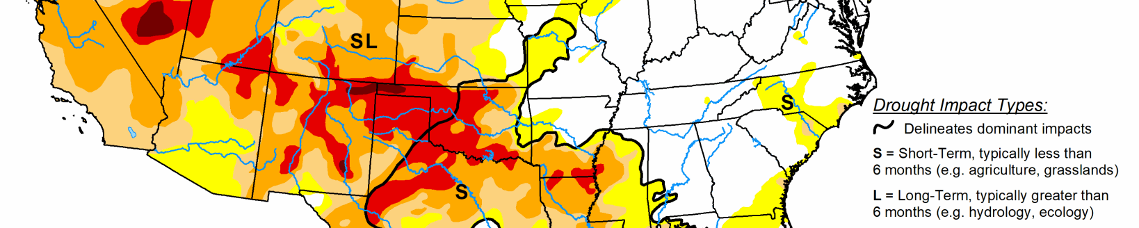
Drought or abnormal dryness contracted where precipitation was above normal, especially in the Northwest, northern Plains, and Mid-Atlantic. Drought or abnormal dryness expanded or intensified where it continued dry, especially in the Southwest, southern to central Plains, Southeast, and parts of the Northeast.
South
All of the states in the South region had areas of rain with amounts of half an inch or more, but large areas also received no rain. Temperatures were persistently hot throughout the week, increasing evapotranspiration, further drying soils, and stressing crops and vegetation. On May 15, Abilene, Texas, recorded eight days in May with 100-degree-F temperatures. This set a new record for the highest number of days in May with 100 degree temperatures. The previous highest number of days for Abilene was 7 days, set in 2000 and in 1927.
Recent dryness is compounding long-term dryness, especially in western parts of the region. By some measures, Culberson County in Texas had the driest September-April on record and second driest December-April, and that is not counting the dryness so far in May. Corpus Christi, Texas, recorded the third driest February-May to date out of 136 years of record.
According to USDA statistics, 86% of the topsoil moisture in Texas was short or very short, and 53% was short or very short in Oklahoma and Louisiana; 74% of the pasture and rangeland was in poor or very poor condition in Texas; and 81% of the winter wheat in Texas and 52% in Oklahoma was in poor or very poor condition. Drought or abnormal dryness contracted in the few areas in Texas and Oklahoma where more than an inch of rain fell on Dx areas. But abnormal dryness and moderate to exceptional drought expanded in many more areas of Texas. Abnormal dryness and moderate to extreme drought expanded in southwest Louisiana, and abnormal dryness grew in Tennessee.
Midwest
A large swath of Minnesota received 2 or more inches of rain, with locally up to 5 inches, and 2 inches or more fell over northern parts of Wisconsin and Michigan. Up to half of an inch fell over parts of the other states in the region, but much of Iowa and parts of southern Wisconsin and Illinois received little rain. The rain removed the abnormal dryness that was in northeast Minnesota.
High Plains
Northern and eastern parts of the High Plains were wet this week while western and southern parts were dry. Two inches to locally over 4 inches of precipitation fell over parts of North Dakota and eastern Montana, and half an inch or more was widespread over the Dakotas, northern Wyoming, and eastern parts of Nebraska and Kansas. But most of Colorado received no precipitation this week and very little occurred over southern Wyoming and western parts of Nebraska and Kansas.
Moderate to exceptional drought expanded in Colorado, extreme to exceptional drought expanded in Kansas, extreme drought expanded in Nebraska, and abnormal dryness expanded in western Montana. To the north, abnormal dryness and moderate to severe drought contracted in North Dakota, eastern Montana, and northern Wyoming. Severe to extreme drought expanded in Meade County, South Dakota, to reflect impacts and moisture conditions that included low or no surface water, very short pasture and range conditions, and general poor vegetation.
The widespread D3 degradations through southeast Colorado and into the San Luis Valley were a result of very dry and windy conditions over the last few months. According to USDA statistics, in Colorado, 52% of the pasture and rangeland and 45% of the winter wheat were in poor to very poor condition, and 41% of winter wheat in Kansas was in poor or very poor condition, with the statistics 77% for pasture and rangeland in Montana, 49% for pasture and rangeland in Wyoming, 44% for pasture and rangeland in South Dakota, and 41% for pasture and rangeland in Nebraska. The USDA statistics show 60% of Colorado’s topsoil short or very short of moisture, 73% for Montana, 58% for Wyoming, 51% for Kansas, and 37% for Nebraska.
West
Pacific weather systems brought 2 or more inches of precipitation to the coastal ranges and windward portions of the Cascades in Oregon and Washington, with half an inch or more from northeast Oregon to northern Idaho and in eastern Montana. Less than half an inch fell in other parts of the Pacific Northwest and northern Rockies. Little to no precipitation occurred across the southern states in the West region, from California to New Mexico. Weekly temperatures averaged cooler than normal except in the Four Corners states. The hot temperatures in New Mexico continued to increase evapotranspiration and dry soils.
The Calf Canyon/Hermits Peak fire exceeded 298,000 acres burned, becoming the largest wildfire in modern New Mexico history. Moderate to exceptional drought expanded in New Mexico; extreme drought expanded in Utah; moderate to extreme drought expanded in Arizona; and exceptional drought from Nevada crept southward into northwest Arizona. Further north, extreme drought was removed from Washington, while abnormal dryness and moderate to exceptional drought contracted in Oregon. The precipitation of recent months in the Pacific Northwest has helped refill some reservoirs, especially the smaller ones. But larger ones remain depleted, including Oregon’s Crescent Lake reservoir, which is 12% full, Prineville (32%), Phillips (13%), Warm Springs (18%), Owyhee (46%), Howard Prairie (16%), Emigrant (26%), and Hyatt (20%). According to USDA statistics, 89% of the topsoil moisture was short or very short in New Mexico, 47% in Utah, and 40% in Nevada, and 51% of the pasture and rangeland was in poor or very poor condition in New Mexico.